
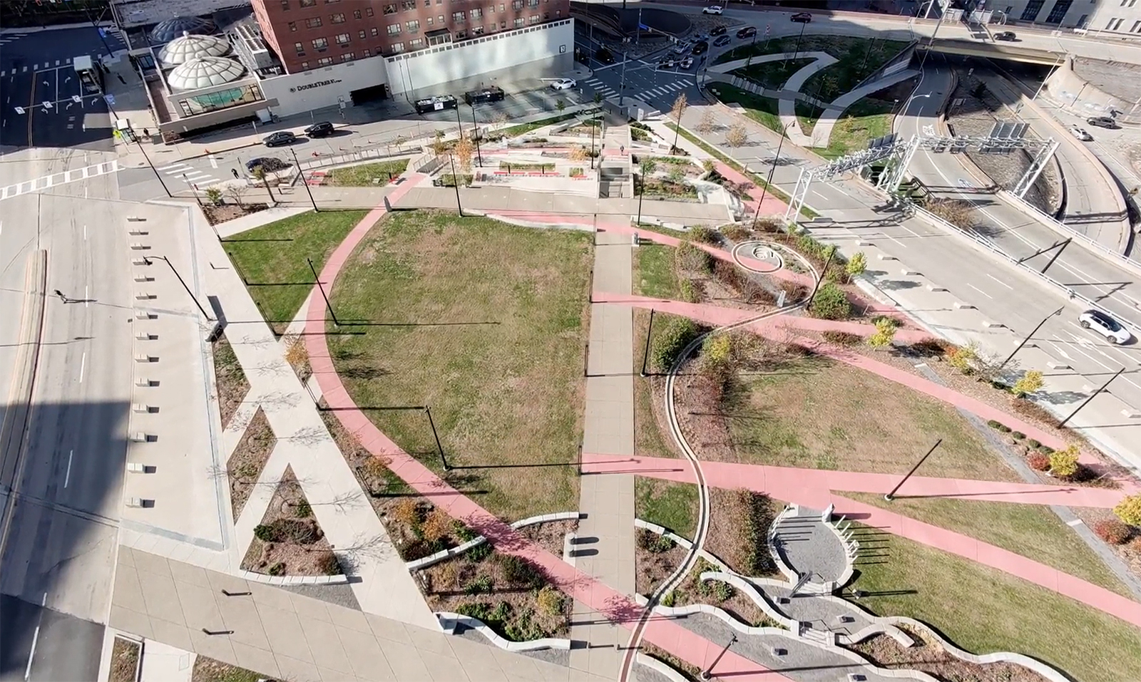
The I-579 Cap Project reconnects Pittsburgh’s historic Hill District with downtown, restoring a vital link that was lost in the 1950s. What was once a mobility barrier created by Interstate 579 is now Frankie Pace Park—a vibrant, three-acre public space featuring pedestrian pathways, recreation and performance areas, rain gardens, and installations created by local artists.
Key Stats:
~$35M
Total Investment
~300 ft
Interstate Covered
3 acres
New Public Space
Design Team:
- HDR (Lead)
- LBA Landscape Architecture
- Santangelo & Lindsay
- WC3 Design
Artists:
- Dr. Kimberly Ellis
- Renee Piechocki
- Amir Rashidd
- Lakeisha Byrd
- Jann Rosen-Queralt
Project Overview
Connecting Hill District to Downtown Pittsburgh
Completed in 2021, the I-579 Cap Project restored direct connections between Pittsburgh’s historic Hill District and the business and cultural center of the city’s downtown.
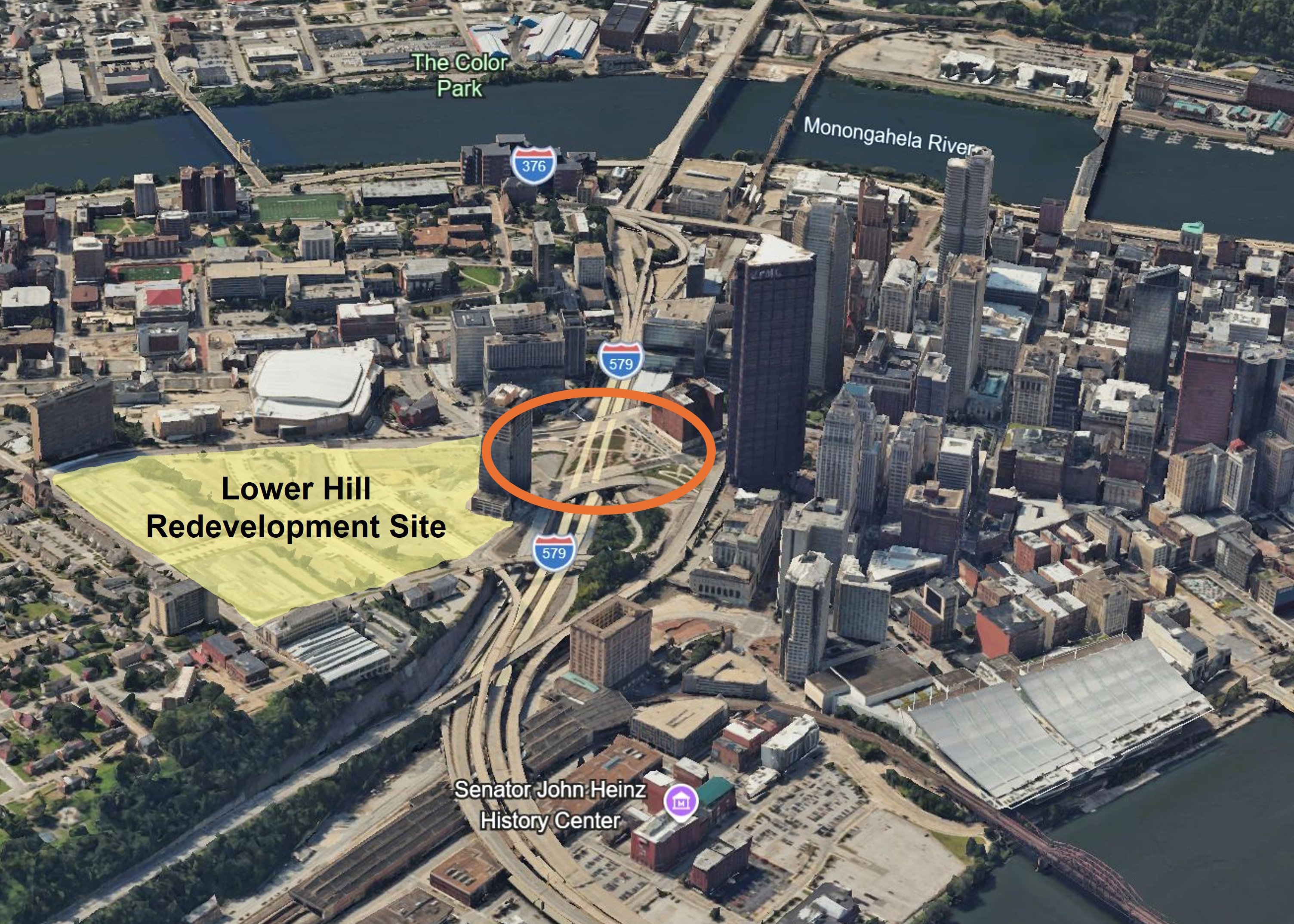
Frankie Pace Park covers a 300-foot section of I-579 / Crosstown Boulevard, bounded by Washington Place, Centre Avenue, Chatham Street, and land north of Bigelow Boulevard.
Image Source: Google Earth
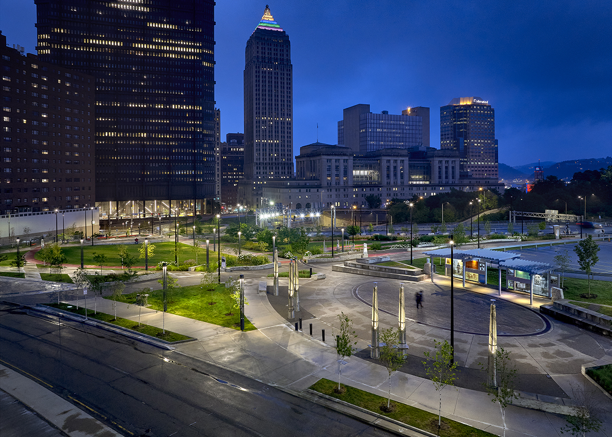
Three acres of new public space and pathways restore pedestrian access between the Hill District and Downtown Pittsburgh.
Image Source: LBA Landscape Architecture
Credit: Ed Massery
The Complete Story
From vision to reality: How the I-579 Cap Project transformed a transportation barrier into a community connector.
-
Project Context
Constructed between 1957 and 1977, I-579 runs through central Pittsburgh connecting Pennsylvania Route 885 to I-279. The section of the highway that runs below street level near the former site of the Civic Arena created a 300-foot-wide canyon between Pittsburgh’s historic Hill District and the city’s downtown and cultural center. Bridges on Centre Avenue and Bigelow Boulevard served as the primary connection points across this section of highway, but their deteriorated and substandard sidewalks limited options for pedestrians to safely cross into Downtown Pittsburgh or access public transit on the other side of the highway.
-
Vision and Goals
After the demolition of the Civic Arena in 2012, redevelopment efforts led by the City of Pittsburgh, the Urban Redevelopment Authority (URA), the Sports & Exhibition Authority of Pittsburgh and Allegheny County (SEA), and the Pittsburgh Penguins ice hockey team, among others, sought to use the 28-acre site for mixed-use and mixed-income developments that could reconnect the Hill District to Downtown Pittsburgh. Expanding safe multimodal options for crossing the sunken portion of I-579 was a central part of this vision.
SEA was selected as design lead for the project. They engaged Hill District community members to conceptualize a public park covering the 300 feet of highway between Bigelow Boulevard Bridge and Centre Avenue Bridge. The goals of the project were not only to provide a safe multimodal crossing and new public space for community members, but also to catalyze further investment in support of Lower Hill District redevelopment.
-
Project Partnerships and Funding
In 2015, SEA partnered with the City of Pittsburgh to secure a $1 million planning grant from USDOT's Transportation Investment Generating Economic Recovery (TIGER) VII program for preliminary design and stakeholder engagement. With this initial funding, SEA and the City convened additional partners, including the Pennsylvania Department of Transportation (PennDOT), to achieve two important milestones toward construction funding eligibility. First, the Cap Project was approved as part of the Southwestern Pennsylvania Commission’s (SPC) Long-Range Plan. Second, with PennDOT’s support, the project received NEPA review through a categorical exclusion from the Federal Highway Administration (FHWA). In 2016, FHWA awarded SEA and the City of Pittsburgh a $19 million TIGER VIII grant for final design and construction of the I-579 Cap Project, helping secure an additional $13 million in funding matches from state, local, and private contributors.
-
Stakeholder Engagement and Public Input
SEA led an extensive stakeholder engagement and design review process, beginning with the $1 million TIGER VII planning grant from USDOT and lasting until project construction in 2019. During this period, SEA and project partners held more than 50 stakeholder meetings to gain buy-in, gather feedback on project design and park features, present preliminary and final designs for community input, and engage local artists to design the park’s art installations. Community meetings were hosted at familiar locations in partnership with the Hill Community Development Corporation (CDC), Community Empowerment Association, and other local organizations to maximize participation.
-
Project Design
To design the cap, the team needed to develop project-specific standards and approaches to cover the unique space between the Centre Avenue and Bigelow Boulevard bridges, including a change in surface elevation between the two sides of the highway. One of the key challenges the team faced was creating new foundational structures capable of supporting the park’s load while preserving the highway’s retaining walls and minimizing impacts to existing foundations. To address this challenge, the design team chose an innovative foundation technique that involved drilling deep, narrow supports behind the existing walls. For the cap structure, the team chose conventional materials, including precast concrete beams set across four multicolumn piers installed in gore areas (the space between converging lanes) and medians. Lightweight foam blocks would be placed on top of the structure to accommodate the park’s topography while minimizing soil weight. The design team also included multiple layers of waterproofing between the park and cap structure to minimize future maintenance and extend the life of the project.
-
Project Construction
Construction of the I-579 Cap Project took place between June 2019 and November 2021. Throughout construction, the project team minimized disruptions to highway traffic, closing just one exit ramp and working within small construction areas between lanes to drill the multicolumn piers. Limited nighttime closures were allowed while the construction team lifted in 126 concrete beams to close off the roof of the cap—a process that took just 38 days. After completing the structural cap, engineered foam blocks and soil were laid on top of the beams, followed by final landscaping and park construction to make Frankie Pace Park a reality.
-
Impact and Outcomes
Today, the I-579 Cap Project provides Hill District residents safe routes to Downtown Pittsburgh, public transit from the nearby Steel Plaza subway station, and improved access to an estimated 78,000 jobs. Frankie Pace Park, which continues to be operated and maintained by the City of Pittsburgh, gives Hill District residents access to three acres of outdoor recreation, event, and community space. The project will continue to support ongoing development and reinvestment in the Lower Hill District as part of the Lower Hill Redevelopment Plan. The project has received numerous awards, including the 2022 national grand prize in the America's Transportation Awards Competition.
Vision, Goals, and Objectives
The I-579 Cap Project grew out of the Lower Hill Redevelopment Plan, an effort led by the Pittsburgh Penguins to transform the site of the former Civic Arena into a multi-use, mixed-income urban grid. The Pittsburgh Penguins had received rights to develop the 28-acre site in an agreement to build a new arena and keep the Penguins’ NHL franchise in the city.
The cap would fill the 300-foot-wide canyon over I-579 between the Centre Avenue Bridge and Bigelow Boulevard Bridge. On top of the cap, a park would provide new public green space and mobility options for Hill District residents to access Downtown Pittsburgh. Creating the park would be an important first step to catalyze broader investment and redevelopment in the Lower Hill area within the Hill District.
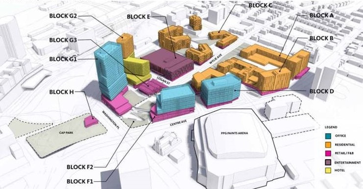
Preliminary Land Development Plan for 28-acre site of the former Civic Arena.
Image Source: Lower Hill Redevelopment
SEA was selected to lead design of the I-579 Cap Project, given their previous experience leading the North Shore Development Project in 2003. They engaged government stakeholders and local community members early in the design process to define several goals for the I-579 Cap Project, including:
- Restoring safe multimodal access between the Hill District and Pittsburgh’s downtown.
- Creating new public space that will honor the history of the Hill District through park design elements and art installations.
- Catalyzing further investment to support the City’s redevelopment plan for the Lower Hill.
Partnerships and Funding
Early partners involved in the Lower Hill Redevelopment Plan included SEA and URA, as owners of the 28 acres of land, and the Pittsburgh Penguins, which held exclusive rights to develop the area.
As project design lead, SEA played a central role in convening other key partners to make the project a reality. This included the City of Pittsburgh, who would ultimately own, operate, and maintain the park; PennDOT, who would support NEPA compliance and ultimately serve as a pass-through for federal funding; community organizations, including the Hill District Consensus Group and Hill Community Development Corporation, who would help convene and advocate on behalf of community stakeholders; and local philanthropic organizations with whom SEA had built relationships through the North Shore Development Project.
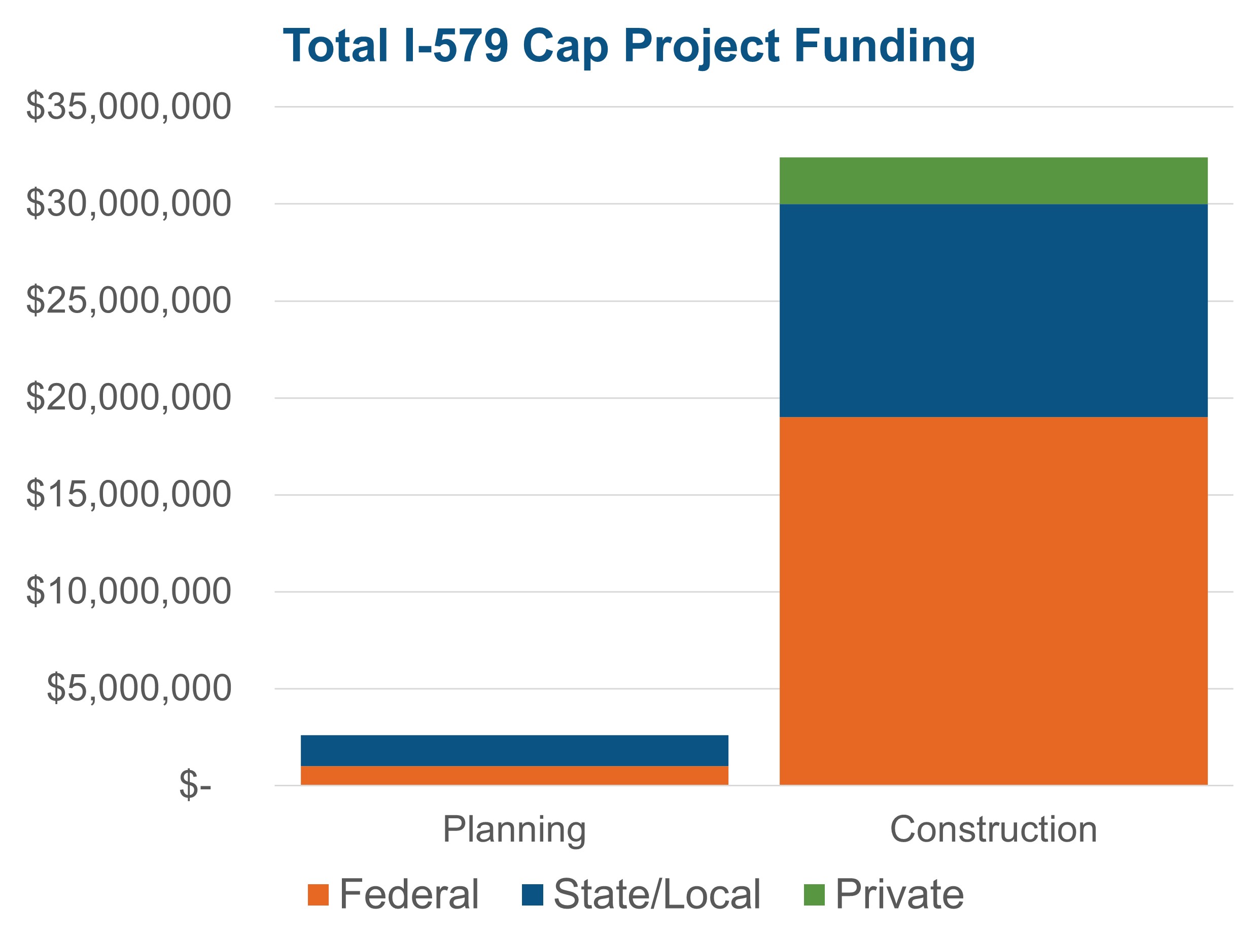
Project costs totaled approximately $35 million, including around $3 million for preliminary planning and design and $32 million for project construction, funded by a mix of federal, state, local, and private contributions.
SEA’s partnership with the City was formalized in their 2015 application to the USDOT TIGER VII grant program. Construction funding was not approved at this stage, but SEA did receive around $1 million from FHWA to support further project design and planning. In 2015, SEA successfully engaged PennDOT to support NEPA review, and presented the project to the Southwestern Pennsylvania Commission (SPC) for inclusion in its Long-Range Plan. SEA leveraged their partnerships with city, state, and philanthropic partners to secure funding commitments, and in 2016, they were awarded a $19 million grant for project construction under USDOT's TIGER VIII program. With construction funding in hand, the project became eligible for additional statewide funding programs, including the PA Redevelopment Assistance Capital Program and Keystone Recreation, Park, and Conservation Fund.
Funding Sources
| Source | Program/Type |
|---|---|
| U.S. Department of Transportation / Federal Highway Administration | TIGER VII Discretionary Grant FY2015 (~$1 million for planning and preliminary design) |
| U.S. Department of Transportation / Federal Highway Administration | TIGER VIII Discretionary Grant FY2016 ($19M for project construction) |
| Pennsylvania Department of Transportation (PennDOT) | Multimodal PennDOT |
| Pennsylvania Department of Community and Economic Development | Multimodal Transportation Fund |
| Commonwealth of Pennsylvania | PA Redevelopment Assistance Capital Program |
| Pennsylvania Department of Conservation and Natural Resources | Keystone Recreation, Park, and Conservation Fund |
| Allegheny County Sanitary Authority (ALCOSAN) | Local funds |
| Sports & Exhibition Authority of Pittsburgh and Allegheny County (SEA) | Local funds |
| Urban Redevelopment Authority of Pittsburgh | Local funds |
| Richard King Mellon Foundation | Private/Philanthropic Support |
| Hillman Foundation | Private/Philanthropic Support |
| Heinz Endowments | Private/Philanthropic Support |
| Colcom Foundation | Private/Philanthropic Support |
Stakeholder Engagement
After winning the $1 million planning grant from FHWA, SEA led a comprehensive stakeholder engagement and design review process. This process, which took place from 2015 during preliminary design until project construction in 2019, included approximately 75 stakeholder meetings, presentations, and feedback sessions to ensure residents and other stakeholders had a voice in the project. Community feedback and priorities were documented, reviewed by the design team, and integrated into the final park design.
Summary of Engagement Activities
- 50+ Total Stakeholder Meetings
- ~20 Events Hosted by Community Organizations
- ~8 Events on Business and Job Opportunities
- ~6 Meetings on Art Integration
- ~3 Public Input Meetings on Final Cap Design
- 1 Survey and Social Media Campaign
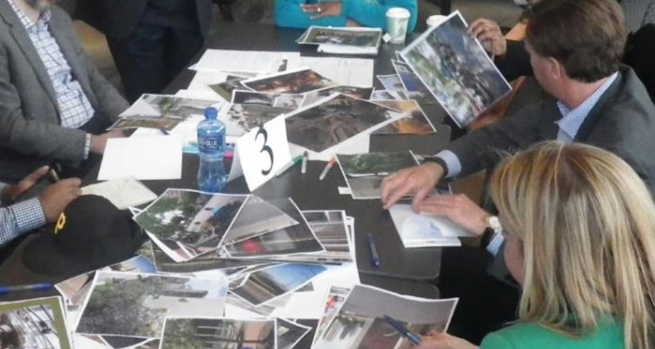
Community design workshop.
Image Source: HDR, Inc.
Summary of Community Priorities
- Green space
- Integration of art, music, and performance space
- Water features and interaction, especially for children
- Adequate seating and shading for community gatherings
- Connection with the community’s history
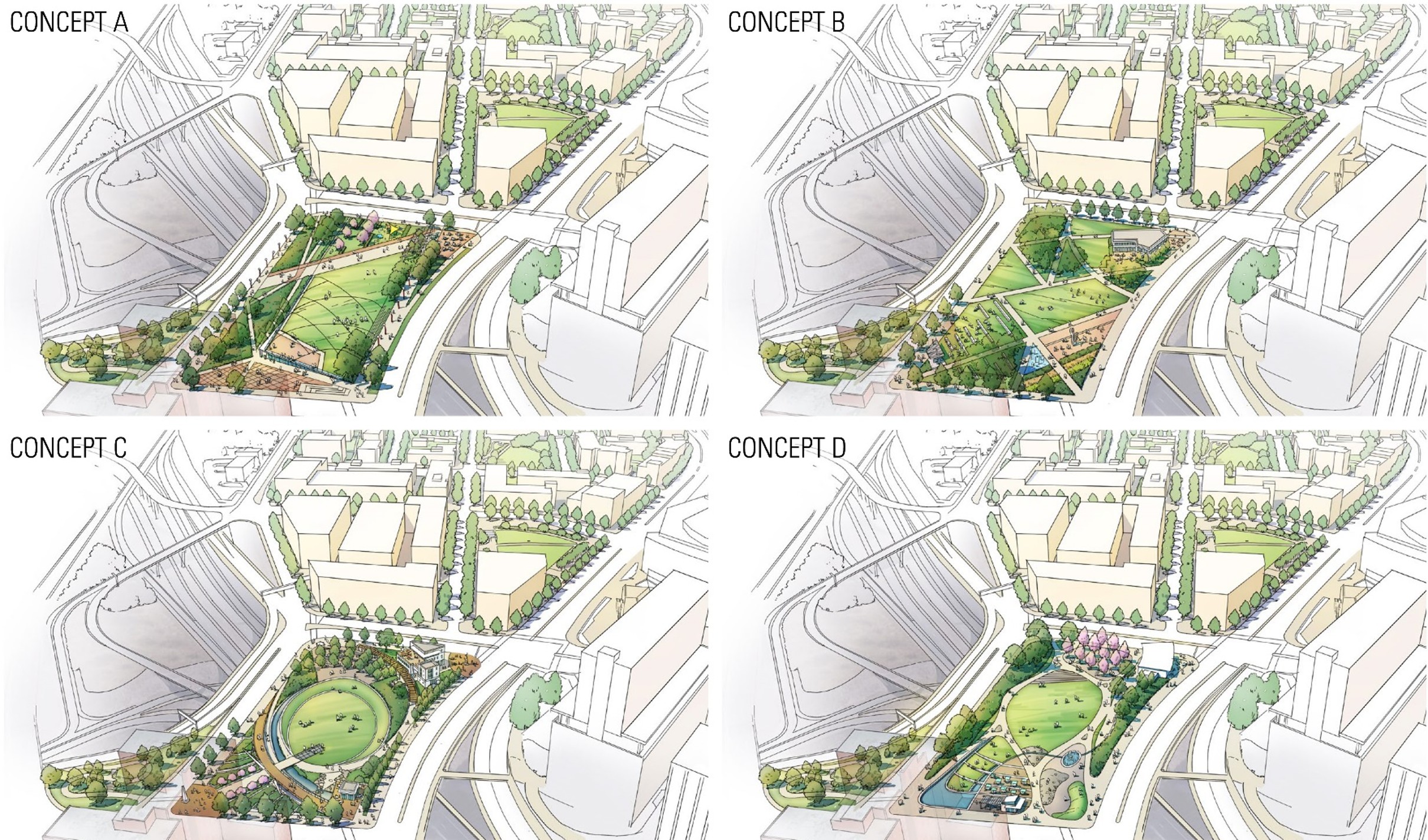
Community involvement concept plan options.
Image Source: HDR, Inc.
Features of the Stakeholder Engagement Process
- Design workshops involved the community in the preliminary and final design stages.
- Community meetings took place at familiar and accessible locations in the Hill District to encourage participation.
- SEA partnered with trusted community organizations including Hill District Consensus Group, Hill Community Development Corporation, and Community Empowerment Association.
- An online survey and social media campaign provided additional feedback channels for residents to share their input and have a voice in the project.
- SEA engaged local artists to design park amenities and features that reflect the Hill District’s history.
Project Design and Construction
Designing the I-579 Cap Project required the design team to overcome unique challenges related to the project’s location near existing structures, limited construction space, and limited precedent for capping an active interstate with a public park. For the cap structure, they applied creative, project-specific approaches to building with conventional construction materials. Using conventional building materials allowed the team to streamline cap construction, reduce future maintenance costs, and preserve funds for the community-informed aspects of the park on top.
Cap Design Elements
- Over 200 narrow supports (micropiles) drilled behind retaining walls to create the foundational structure
- Preservation of existing highway retaining walls
- Four multicolumn piers installed in medians and between converging lanes (gore areas)
- 126 precast concrete beams
- Multiple layers of waterproofing to prevent water damage from the park
- Fiber-reinforced protection slab on top of the waterproofing layers to prevent damage
- Lightweight engineered foam blocks to reduce soil load
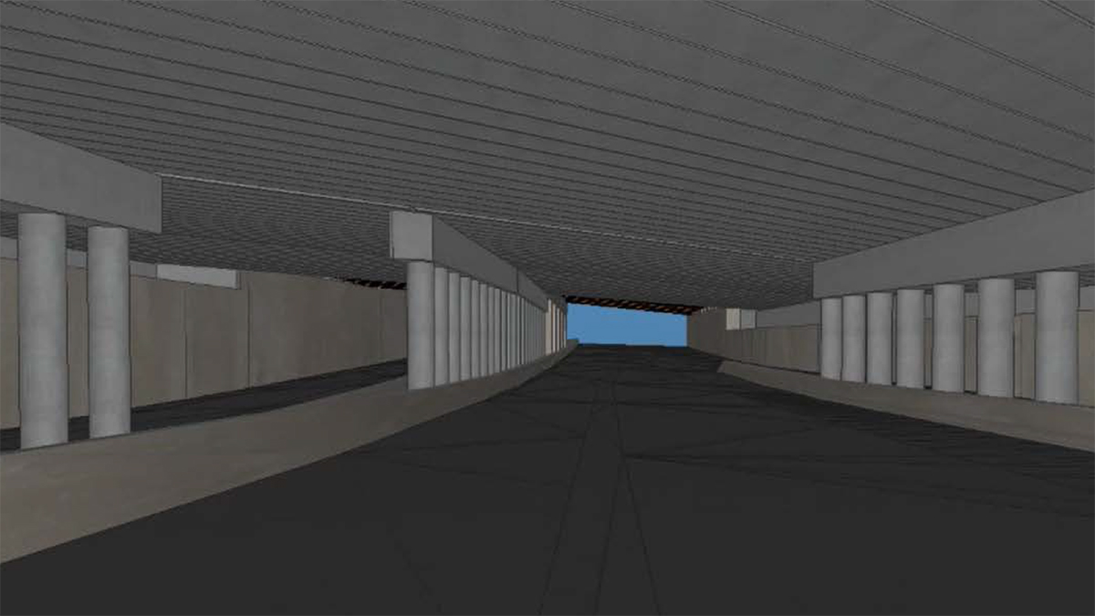
The design team chose conventional materials for the cap structure, including multicolumn piers that could be drilled into medians and the space between converging lanes, and precast concrete beams for the roof of the structure.
Image Source: HDR, Inc.
Park Design Elements
- Walking paths and pedestrian connections to surrounding areas
- Public art and story walls created by local artists to honor the community’s history
- Integration of music including drums and chimes for park users to play
- Seating areas and community gathering spaces
- Outdoor classroom and amphitheater
- Rain gardens and a watercourse for stormwater management
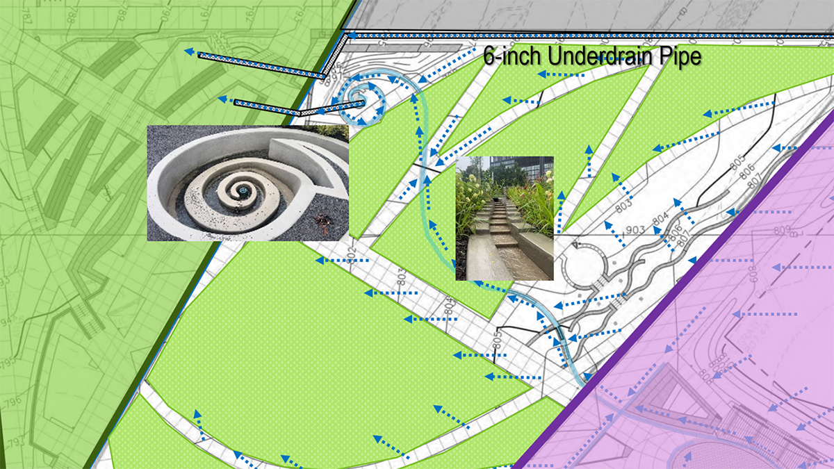
Extensive waterproofing, unique drainage features, a water-holding soil mix, and a rain garden protect the structure from water and ice damage.
Image Source: HDR, Inc.
Construction
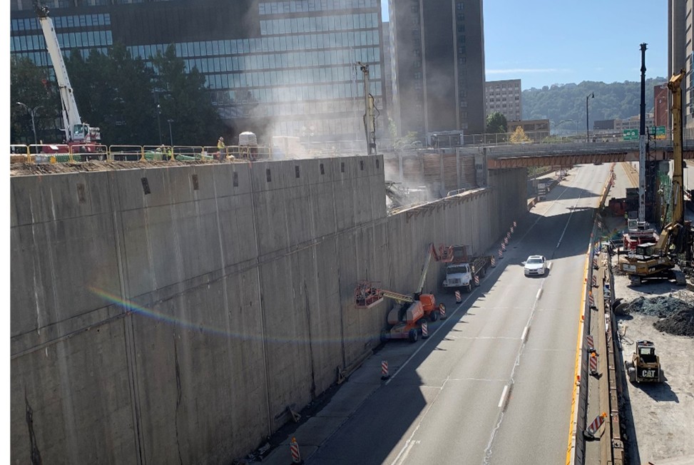
Retaining walls were lowered, and behind them over two hundred narrow supports (micropiles) were drilled to create the foundational structure.
Image Source: HDR, Inc.
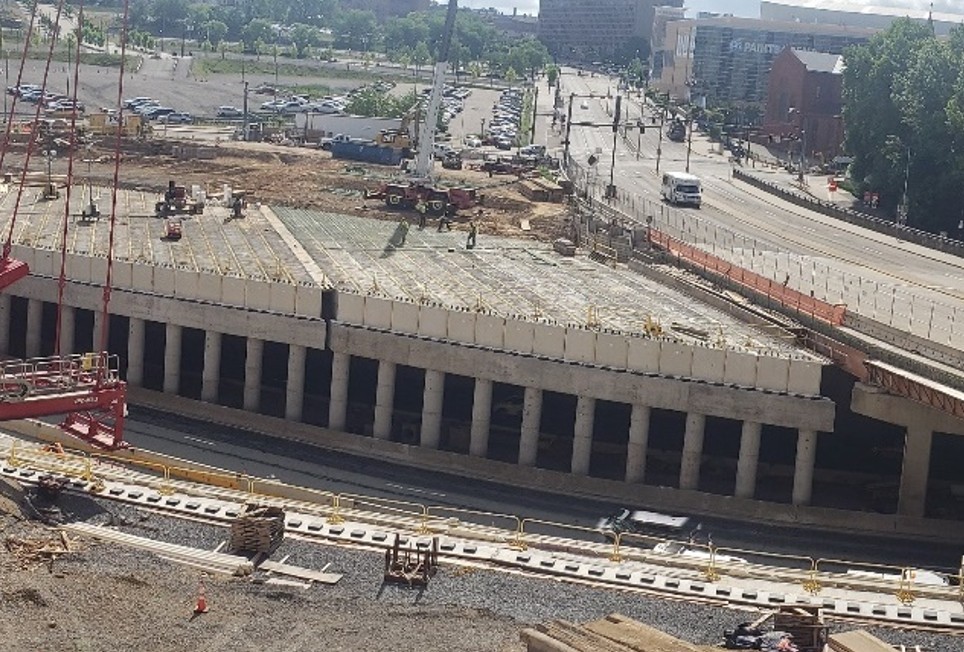
Over the course of just 38 days, 126 precast concrete beams were set on four multicolumn piers to close the roof of the cap structure.
Image Source: HDR, Inc.
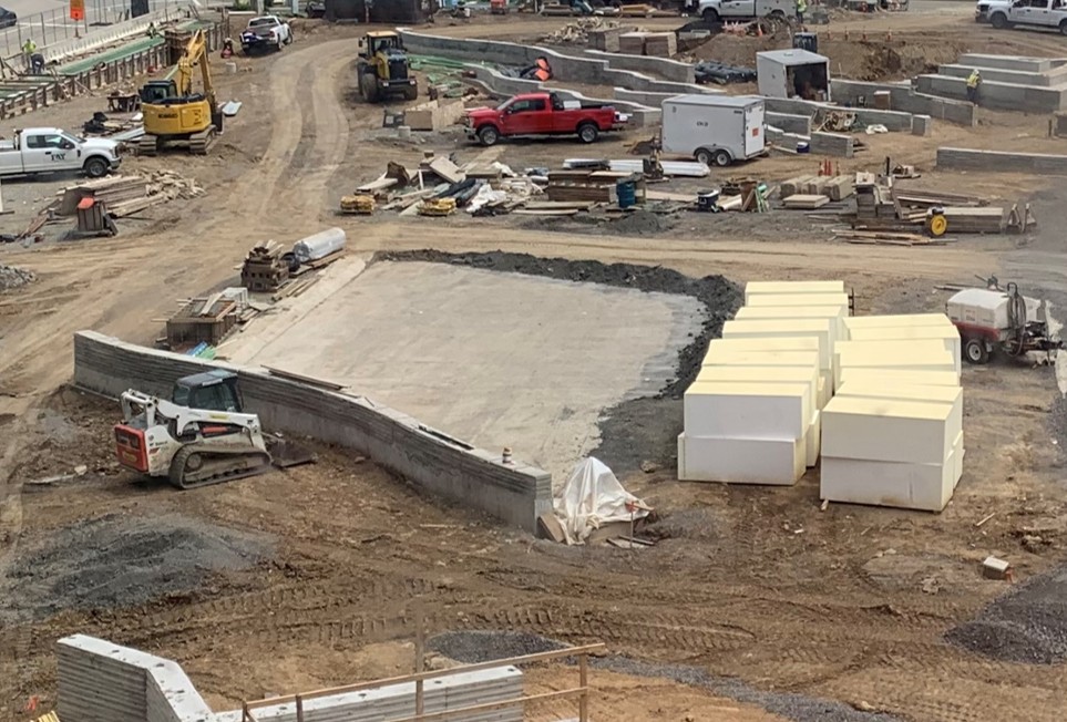
Lightweight engineered foam blocks were buried in the deeper areas of the park to reduce the weight of soil on the structure.
Image Source: HDR, Inc.
Project Outcomes
The I-579 Cap Project demonstrates visible and measurable transportation, economic, and community benefits.


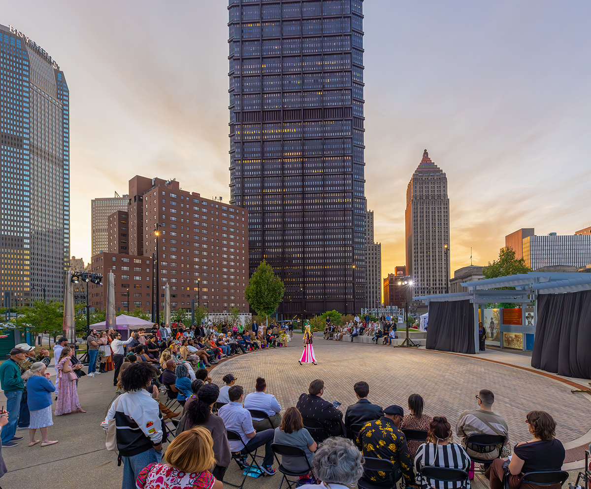
Frankie Pace Park includes pedestrian paths, event lawns, an outdoor classroom, an amphitheater, rain gardens, and local art. Extensive lighting ensures visibility for drivers passing under the park.
Image Source: LBA Landscape Architecture
Credit: Elan Mizrahi Photography
Project Awards
- Project of the Year (2023) - American Society of Highway Engineers
- Honor Award (2023) - Engineering Excellence Awards, American Council of Engineering Companies
- Honor Award (2023) - American Society of Civil Engineers
- Design Award (2023) - Transportation, Best Non-Highway Bridge, Precast/Prestressed Concrete Institute
- Diamond Award (2023) - Engineering Excellence Awards, American Council of Engineering Companies of Pennsylvania
- Special Project Award (2022) - March of Dimes, Pittsburgh
- Civil Engineering Achievement Award (2022) - American Society of Civil Engineers, Pittsburgh Section
- Excellence in Structural Engineering Award (2022) - National Council of Structural Engineers Associations
- Grand Prize Award (2022) - America's Transportation Awards, American Association of State Highway and Transportation Officials
- Merit Certificate (2022) - Concrete Reinforcing Steel Institute
Lessons Learned
Throughout the process of planning, designing, and constructing the I-579 Cap Project, partners learned several key lessons that can inform other communities pursuing similar projects. Click each lesson below to learn more.
A Bridge Between Neighborhoods
The I-579 Cap Project does more than create a bridge over an interstate; it reconnects two areas of Pittsburgh after decades of separation, restoring a long-absent link between the city’s Hill District and Downtown. Communities across the country with mobility barriers caused by transportation infrastructure can look to Pittsburgh as an example.
Frankie Pace Park makes it easier for residents to travel between the Hill District and Downtown Pittsburgh, while also creating a space to stop, rest, gather, and reflect on their community's past, present, and future. The park has become a catalyst for additional redevelopment efforts in the area aimed at restoring the city's urban fabric.
RCI provides free technical assistance to communities at any stage of scoping, planning, or implementing reconnection projects. Click below to request RCI technical support, and explore the RCI website for additional tools and resources for advancing transportation reconnection projects.
Acknowledgements
This case study is based upon work supported by the Office of the Secretary of Transportation under contract number 47QRAD20DU148. Any opinions, findings, conclusions, or recommendations expressed in this publication are those of the author(s) and do not necessarily reflect the views of the Office of the Secretary of Transportation.
Contributors
- Nicholas Burdette, HDR, Inc.
- Dr. Lloyd Cheatom Sr., POGOH
- Dr. Kimberly Ellis, Historic Hill Institute
- Michael Leckie, LBA Landscape Architecture
- Tom Ryser, Sports & Exhibition Authority of Pittsburgh and Allegheny County
- Doug Straly, Sports & Exhibition Authority of Pittsburgh and Allegheny County
- Nazia Tarannum, City of Pittsburgh
- Zack Workman, City of Pittsburgh
Sources
- HDR, “I-579 Open Space Cap.” HDR. Accessed March, 2026: https://www.hdrinc.com/portfolio/i-579-urban-open-space-cap
- Sports & Exhibition Authority of Pittsburgh and Allegheny County (SEA), “Frankie Pace Park (I-579 CAP Urban Connector Project).” SEA. Accessed March, 2026: https://www.pgh-sea.com/index.php?path=i5-ucp
- Lower Hill Redevelopment. Accessed March, 2026: https://www.lowerhillredevelopment.com
- Smith, Kyle, Nick Burdette, and Roger Eaton. 2023. "Building a Park over an Interstate." ASPIRE: The Concrete Bridge Magazine. Summer 2023: https://aspirebridge.com/magazine/2023Summer/CBT-BuildAParkOverAnInterstate.pdf
- FHWA Center for Innovative Finance Support, “Project Profile: I -579 ‘Cap’ Urban Connector Project: Bridging a Critical Gap to Revitalize the Hill District, Pittsburgh, Pennsylvania.” FHWA Center for Innovative Finance Support. Accessed March, 2026: https://www.fhwa.dot.gov/ipd/project_profiles/pa_i579_cap_urban_connector_project.aspx
- Burdette, Nick (n.d). Reconnecting the Community: the I-579 Urban Open Space Cap [Unpublished Powerpoint slides]. HDR.
- Eaton, Rodger, Nicolas Burdette and Justin Doornink. “Reconnection: How highway caps help fix the past's poor designs." Roads & Bridges Magazine, July/August 2022: https://www.roadsbridges.com/magazine/71707